
Understanding the Green River’s Unique Course
There is no need to brush up on school time to know that rivers begin in the mountains and literally fall to the sea. Essentially, gravity takes care of everything. This is how all rivers on the planet work. What’s more, if you spill a glass of water on the floor, you could discover if there is an unevenness. However, sometimes fine print can confuse what initially seems logical.
The Mystery of the Green River
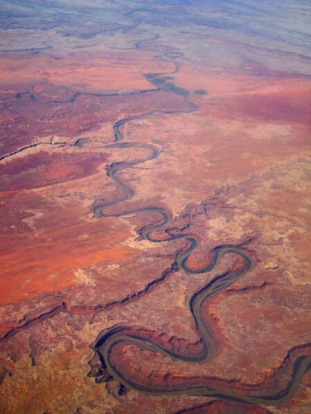
Specifically, the Green River in Colorado (United States) has perplexed the scientific community for 157 years. It flows through the Uinta Mountains (Wyoming/Utah) instead of around them to join the Colorado River. A recent study sheds light on the geodynamic mechanisms enabling this extraordinary phenomenon, challenging our preconceptions of river patterns.
Context: The Uinta Mountains
To understand the significance of this phenomenon, we first need to examine the Uinta Mountains, a notably unusual mountain range. Stretching nearly 250 kilometers from east to west, these mountains are home to peaks reaching up to 4,000 meters. Interestingly, most mountain ranges in the United States trend north-south due to tectonic forces between the Pacific and North American plates.
The formation of the Uintas occurred around 50 million years ago, and this unique structure serves as a fascinating backdrop for the Green River’s erratic course. The river etched its current channel less than 8 million years ago, creating a canyon—about 700 meters in length—that was instrumental in the river’s journey through the mountain range.
The Path of Least Resistance
While rivers generally conform to the principles of gravity, they also follow the path of least resistance. Given this geological understanding, it’s surprising that the Green River chose to cross the mountain range rather than flow around it. The canyon represents a mechanical paradox in an environment without active compressive tectonics.
The Study and Its Findings
Rivers are like historical records, and by examining their current shape, scientists can reconstruct ancient landscapes. Researchers employed a mathematical model involving a 2D topographic inversion of river networks to reveal a significant rise—about 450 meters—in the terrain’s center with a circular pattern. This discovery was validated using seismic tomography, a technique allowing experts to visualize structures deep below the Earth’s surface.
What is a Lithospheric Drop?
A “lithospheric drop” refers to a dense mass of mountain root that becomes detached and sinks into the deep mantle. This drop acts as an internal engine, altering the surface geology and enabling the Green River to traverse the mountain barrier.
Lead author of the study, Adam Smith, explained that “lithospheric trickling is responsible for pulling up the terrain enough to allow rivers to link and merge,” thus establishing the river’s permanent channel.
Importance of the Discovery
This geological event is crucial for several reasons. It united two of North America’s largest river systems, which altered the continent’s drainage patterns and impacted biodiversity by allowing interbreeding among various species. Furthermore, this discovery serves as a poignant reminder that the Earth’s interior continues to shape landscapes, even in regions seemingly devoid of geologic activity.
How It All Happened
By applying Stokes’s Law alongside fluvial response time, scientists estimated this landslide phenomenon occurred 2.3 to 4.7 million years ago. The initial topographic subsidence facilitated the Green River’s passage through the mountain barrier. Later, as the dense root was removed, it created an uplift that continues to shape the landscape today. In essence, the mountain lowered to allow the river to traverse it, only to rise again, compelling the river to cut through solid rock to maintain its course.