
Weather in Germany
DWD Warns of “Extreme Storms” – Maps Show the Situation
The German Weather Service (DWD) has issued a warning for extreme storms with thunderstorms, hail, and strong winds expected on Wednesday. As the situation develops, live maps are available to track the unfolding weather conditions.
On Wednesday, Germany could experience some serious weather disturbances . The DWD anticipates “extreme storms” throughout the day. The forecast indicates, “In the early hours, there will be individual strong thunderstorms moving from the southwest.” In the afternoon, severe thunderstorms are expected from southern Baden-Württemberg to Lower Bavaria and Upper Franconia, posing a high risk of severe weather.
Moreover, the DWD expects hail up to 5 cm, gusty winds reaching 100 km/h, and heavy rainfall of up to 40 liters per square meter within a short period. Extremely severe thunderstorms could produce hailstones up to 8 cm, hurricane-force winds of up to 130 km/h, and intense rain exceeding 40 liters per square meter within a brief time. The storms could also affect areas from Rhineland-Palatinate and Saarland , extending through Hesse and Thuringia to Saxony-Anhalt , northern Saxony, Brandenburg , and Berlin , with wind gusts reaching 85 km/h and heavy rain of up to 25 liters per square meter in a short time, along with small hail.
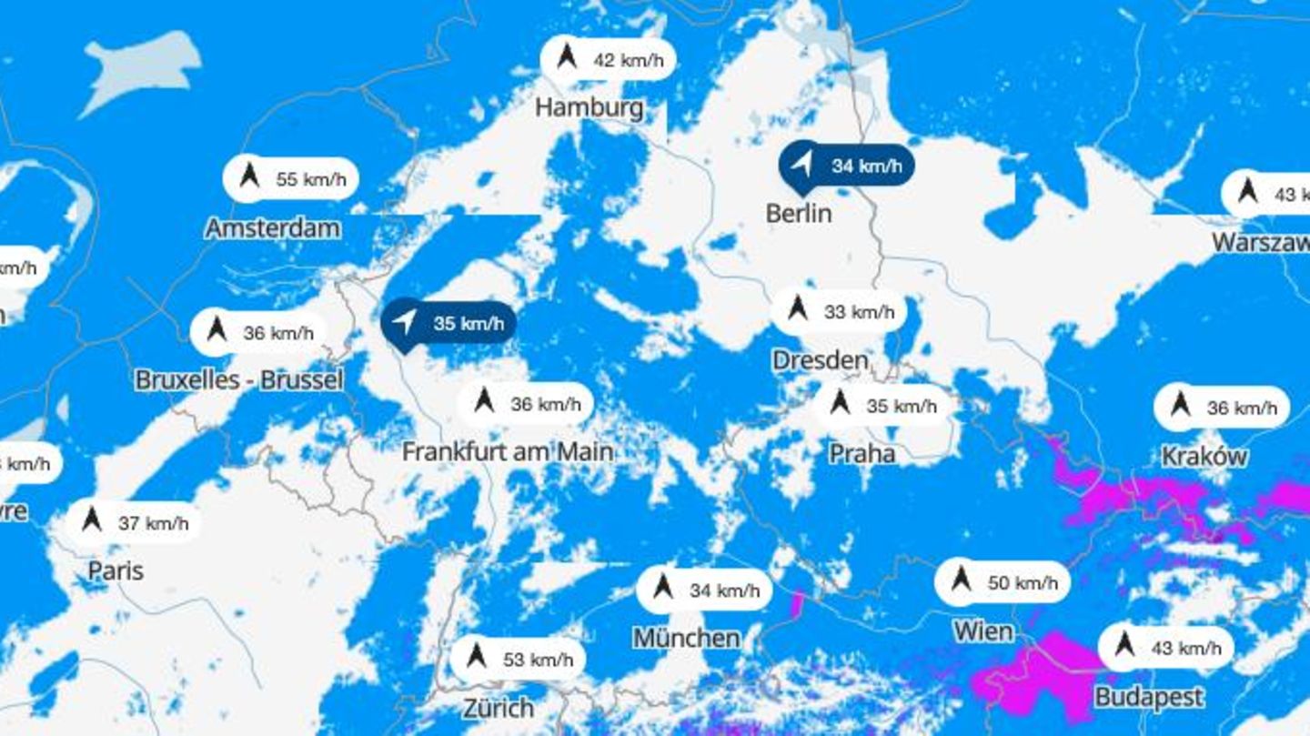
The interactive maps below illustrate the current weather situation:
Weather Map I: Live Storm Tracking
The interactive map below displays real-time weather data. You can also use the timeline at the bottom of the graphic to check future forecasts. The top right allows switching between different weather layers, such as thunderstorms, rain, or snow.
Weather Map II: Today’s Maximum Temperatures
The overview below shows the expected maximum temperatures for today.
Weather Map III: Today’s Fastest Wind Gusts
The map above displays the expected fastest wind gusts for the day.
Weather Map IV: Thunderstorm Warnings for Today
The map above displays the thunderstorm warnings issued by the DWD for today. It uses a binary weather map: locations with thunderstorm warnings are marked in red. No color means no warnings.
Tips for Dealing with Thunderstorms
For protection during severe weather, seek shelter in a solid building or a closed vehicle. In buildings without lightning protection, all electrical devices should be unplugged during a storm.
If you are outdoors, take cover in dips, under overhangs, or concrete bridges. Hunch down with your knees hugged closely to your body, and keep a distance of at least one meter from other people. Avoid metal objects as much as possible.
It’s a myth that “oaks should yield, beech should seek.” Freestanding tall trees are to be avoided, as well as masts or fences. If you are in the woods, crouching down provides better protection.
If the time between lightning and thunder is less than 30 seconds, the storm is about ten kilometers away, so it is wise to seek shelter. Always wait 30 minutes after the last thunder and lightning before venturing out again.
Weather Map V: Thunderstorm Warnings for Tomorrow
The map above displays the thunderstorm warnings for the next day. It also uses a binary weather map, highlighting areas with warnings in red.
The maps utilized come in part from wetter.de, which, like the Stern, is part of RTL Deutschland. Moreover, embedded maps are sourced from Windy.com, which utilizes forecasts from the European Centre for Medium-Range Weather Forecasts (ECMWF).