
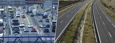
The DGT Traffic Map: A Reliable Road Companion
Every summer, a surge in road trips takes place as families and friends embark on their adventures. Most drivers turn to popular navigation apps like Google Maps and Waze for accurate directions and real-time traffic updates. However, there’s a compelling alternative for those traveling in Spain: the DGT traffic map.
What is the DGT Traffic Map?
The DGT traffic map is a web-based tool specifically designed to provide real-time updates on the status of roads across Spain. Users can access a wealth of information, including details on accidents, road blockages, and construction sites. This tool ensures drivers are well-informed before hitting the road.
Real-Time Updates: A Step Ahead
While Google Maps and Waze rely on crowdsourced data from users to report incidents, the DGT map draws information directly from its own resources. The Dirección General de Tráfico (DGT) employs a network of cameras, aerial monitoring systems, and traffic officials from the Civil Guard Traffic Group. This centralized system ensures that updates are more timely and, importantly, more accurate. Users can see precisely when an incident occurred and how many lanes may be obstructed.
User-Friendly Features
The DGT map may not offer navigation services like Google Maps or Waze, but it compensates with its detailed incident reporting. Users can check the map for various icons that signify different types of incidents. With just a few clicks, drivers can filter the types of events they wish to monitor—be it heavy traffic or accidents—making it a useful tool for pre-trip planning.
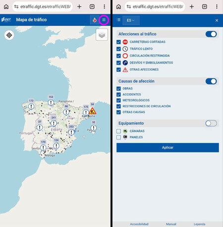
What the DGT map looks like on mobile
Visualization and Details
Upon clicking an incident on the DGT map, users can access comprehensive details about the situation. Information such as the exact time an accident occurred or whether a lane is closed is readily available. Furthermore, traffic density is visually indicated using a color code—red for heavy traffic, orange for moderate, and yellow for light traffic. Additionally, users can identify fires causing road closures by selecting the relevant icon.
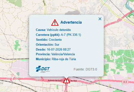
Details revealed by clicking on incidents.