
Weather Update: Buenos Aires Braces for Cold Days Ahead
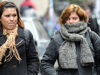
This week, Buenos Aires is preparing for a cold snap characterized by intense minimum temperatures and the influence of polar air across vast regions of Argentina. According to the forecasts from the National Meteorological Service (SMN), this Wednesday will be chilly yet slightly milder compared to the preceding days.
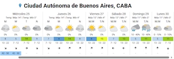
The forecast puts the day’s numbers into sharp focus: the minimum temperature will reach 5 °C during the night, while a moderate recovery is expected, allowing the maximum temperature to climb to 14 °C by afternoon. Despite being a marginal improvement, this slight rise in temperature offers a reprieve after several days of feeling much colder, with the sensation dipping below zero in several areas of the Metropolitan Region.
The cloud cover will remain prevalent throughout the day, tempering temperature fluctuations, particularly during the night. As per the SMN’s data, a westward wind is likely to sweep through at speeds of 7 to 12 kilometers per hour, without notable gusts. While this air circulation adds a touch of freshness to the day, it will not replicate the extreme conditions experienced in previous days, where gusts exceeded 60 km/h. The prediction for precipitation on Wednesday stands at zero, ensuring a dry and steady day, albeit with minimal sunshine.
Forecast for Thursday and Beyond
Looking ahead to Thursday, a new wave of cold and dry air is anticipated, ushering in alterations to the sky conditions. The SMN projects that the minimum will dip to 4 °C with mild winds expected and partly cloudy skies in the morning. However, by noon, conditions are likely to clear up.
The maximum temperature will remain steady at around 14 °C, influenced by the expected solar gain, although the lingering cold air could lead to lower perceived temperatures. Moving into Friday, temperatures are anticipated to hover around a minimum of 4 °C, with clear skies allowing for a potential warming to 15 °C in the afternoon. Additional details suggest a moderate southwest wind that will help maintain dry and stable weather throughout the day.
Weekend Weather Outlook
The weekend kicks off with a Saturday that is expected to be partly cloudy, featuring a minimum of 7 °C and a maximum of 13 °C. The weather conditions are likely to remain stable even into the evening. However, Sunday presents a contrast as southerly winds strengthen, causing temperatures to drop once again. The predicted maximum will hover around 11 °C, with isolated rain showers forecasted for the morning and the possibility of downpours in the afternoon and evening. The probability of precipitation ranges from 10% to 40% according to the SMN.
Monday will follow suit, presenting overcast skies but no anticipated rain, with minimum temperatures at 5 °C and maximums peaking at 11 °C, solidifying the start of the week with chilly conditions devoid of significant meteorological phenomena.

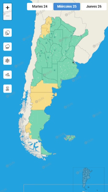
Furthermore, the alert map released by the SMN at 18:04 on Tuesday indicates that regions such as southern Neuquén and parts of Río Negro are under a yellow alert due to wind, with risks that may affect daily activities. Based on the latest temperature advisories, the yellow level for extreme cold remains applicable in northern provinces like Salta, Jujuy, Tucumán, Santiago del Estero, and parts of Formosa and Chaco. In these areas, minimums swing between 2 °C and 4 °C, while maximums exceed 15 °C. While Buenos Aires is navigating through a week of typical winter temperatures, the SMN emphasizes the importance of staying updated with meteorological reports and exercising caution, especially in the early morning hours when minimums pose risks to vulnerable sectors.
General News – 2