
Good News from Siberia: A Surprising Impact on Spain
It is not every day that you can write that good news comes from Siberia . But that’s how it is: the world is warming at an unprecedented rate , Arctic ice has reached historic lows in 2025, and the temperature of the Arctic Circle is increasing up to four times faster than that of the rest of the planet.
And yet, snow coverage in Siberia has reached an above-average extent .
But the important thing is not that. The important thing is not the 15.59 million square kilometers of snow in the northern hemisphere, nor what they mean for the region’s weakened ecosystems. The important thing is that, whether we want it or not, it can be sensational news for Spain.
What Does Siberia Have to Do with Spain?
At the end of the 90s, Judah Cohen, an MIT climatologist, began to notice the blanket of snow that covered Siberia before November. Almost by chance, he discovered that its size kept a very close statistical relationship with climatic patterns occurring in the rest of the continent.
Initially, the international community viewed his findings with suspicion . However, after 20 years of research, the Siberian Snow Advance Index (SAI) has become well-established. Yes, indeed: what happens in Siberia has a lot to do with what happens here in Spain.
How is it Possible?
The mechanism is incredibly simple, yet its implications are enormous. The abundant snow cover in Siberia influences weather patterns across Europe through a feedback loop . “More snow” equals “more albedo,” which leads to more solar reflection, colder soil, and, consequently, a ‘push’ to the Siberian anticyclone . The stronger that anticyclone becomes, the more upward flow into the stratosphere occurs, leading to more sudden warmings and more tropospheric patterns of negative Arctic Oscillation (AO) . In summary, more air masses move towards mid-latitudes, resulting in more storm systems aimed at our geography.
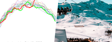
And yes, just take a look at Rutgers Global Snow Lab maps to verify that the extent of snow in mid-late 2025 is more than considerable.
What Does This Mean for Spain?
Essentially, a negative AO and a weakened vortex increase the probability of cold events coming from the north and Atlantic storms shifting southward. This translates to a higher likelihood of more rain and lower temperatures .
On an international scale, high levels of snow in Siberia become a vital signal for Spain to prepare. This encompasses energy , agricultural , and infrastructure planning. It serves as a clear statistical warning that if conditions deteriorate, a complex situation may arise.
Will We Have a Busy Winter Then?
However, it’s not that simple. In meteorology , despite the simplicity and robustness of the mechanism, various factors come into play. What happens in Eurasia interacts with the oceanic/Arctic context and a multitude of other atmospheric processes.
In this regard, greater snow cover in the expansive Siberian plain must coexist with an alarmingly scarce ice cover , which impacts ambient humidity, and various seasonal models indicate a greater probability of above-normal temperatures .
In other words, the situation remains very open-ended. But the Siberian signal is here, and if conditions maintain this trend until November, it will be good news for Spain. News that could turn out surprisingly well.
Image | Copernicus
In Xataka | Ski resorts without snow at the end of the century: the most pessimistic models show what could happen in our high mountains.