
The Return of La Niña: Understanding the Climate Phenomenon
Meteorologists are once again focusing their attention on the center-east strip of the Pacific Ocean, a region crucial for predicting climate variations due to the Southern Oscillation . This phenomenon is primarily driven by temperature fluctuations in the Pacific, and current data suggests that the pendulum is swinging back towards La Niña .
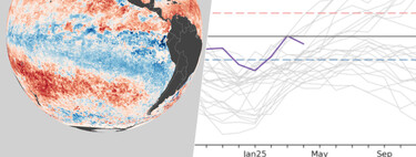
According to the latest information from the National Oceanic and Atmospheric Administration (NOAA) Climate Prediction Center (CPC), there is a 71% probability that a La Niña event will manifest during the last quarter of this year. Such a forecast underscores the importance of closely monitoring conditions in this vital region.
Because of these findings, the CPC has issued an “ENSO alert state” , specifically categorizing current conditions as “Surveillance of La Niña.” This designation indicates that conditions are favorable for developing either El Niño or La Niña within the next six months, and it represents the initial alert state defined by NOAA. Following this stage, agencies provide further warnings as conditions evolve, including transitions to El Niño or La Niña warnings—designating the commencement and conclusion of these climatic events.
What Does La Niña Involve? La Niña is generally recognized as the cooler counterpart to El Niño in the oscillation phenomena. While El Niño is linked with warming in the Equatorial Pacific, La Niña signals a cooling of these oceanic waters. The effects of this climatic anomaly predominantly influence regions close to this strip, notably the Pacific coast of South America . Here, the impacts can be significant, resulting in widespread consequences.
La Niña is often characterized by its dry and cool conditions , which can lead to severe droughts. This trend poses considerable challenges to agriculture , particularly in regions reliant on consistent rainfall for crop growth. In short, the implications of La Niña stretch beyond mere temperature changes, influencing food security, water resources, and even economic stability in affected areas.
Global Implications: What About Spain?
While the primary effects of La Niña are felt across the Pacific coast, the consequences of this phenomenon resonate globally, impacting areas such as Spain and wider European climates . Historical data shows that La Niña conditions have brought colder and drier spells to Spain, particularly following periods of intense rainfall. In light of a notably humid previous year, meteorologists caution that conditions could shift as we transition into the hydrological year.
Reassessing Measurement Techniques
As experts closely monitor the evolving climate conditions, a recent announcement from the Australian Bureau of Meteorology (BOM) highlights a pressing need to revise their methodologies for tracking these climatic oscillations. Traditionally, meteorologists use Pacific Ocean temperature as a benchmark: exceeding certain thresholds signifies El Niño, while falling below them indicates La Niña, with a stable range indicating neutrality.
This established method, however, faces challenges due to the rising average temperatures in the region. As these shifts occur, the risk arises of misidentifying more El Niño events than genuinely occur simply due to increased temperatures obscuring the detection of La Niña instances.
In conclusion, the potential emergence of La Niña towards the end of 2023 brings significant implications for various geographical regions. Understanding and communicating the risks associated with La Niña will be critical for governments, industries, and individuals alike. As climate systems continue to evolve amidst global warming trends, adapting our measurement and forecasting practices becomes essential for accurate climate prediction.