
Understanding Mexico’s Earthquake Activity: A Recent Example
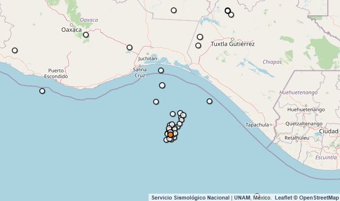
On August 12, 2025, Mexico was shaken by two notable earthquakes in the Chiapas region. The first quake, measured at magnitude 4.4 , struck at 00:33, approximately 170 kilometers southwest of Tonalá, Chiapas. This tremor reached a depth of 16.1 kilometers , causing minor concern among residents and authorities alike. The second earthquake occurred shortly after, at 01:57 , registering a magnitude of 4.3 at a depth of 16.2 kilometers and located 174 kilometers south of Tonalá . The geographic coordinates of this quake were latitude 14.695° and longitude -94.515° .
In such incidents, it is vital to understand the geological background of the region. Mexico lies in a highly seismic zone , primarily due to its location over five tectonic plates: the Caribbean , North America , Pacific , Rivera , and Cocos plates. The constant interaction among these plates results in frequent earthquakes, making it essential for residents and authorities to prepare for such natural events.
The Geology Behind Mexico’s Earthquakes
Mexico’s geographic position and tectonic activity contribute significantly to its earthquake frequency . The Cocos Plate , moving beneath the North American Plate, is particularly volatile and is responsible for some of the strongest seismic activities recorded in the country. As a result, residents are often reminded of the need for earthquake preparedness , including maintaining emergency kits, securing heavy furniture, and being familiar with safety protocols.
In light of the recent events in Chiapas, the role of the Seismic Monitoring Network (SSN) becomes even more critical. The SSN is dedicated to monitoring seismic activity across Mexico, providing timely alerts and data to help residents respond accordingly.
This proactive approach enables citizens to be informed about potential risks and, when prepared, mitigates the effects of these natural disasters.
Impact on the Local Community
While the magnitude of the recent earthquakes might seem moderate, even minor tremors can have significant implications for communities in seismic zones. In Chiapas, local emergency services were prepared for potential aftershocks and ensured that residents were aware of safety protocols.
Community centers were opened to provide information and support, particularly for vulnerable populations, such as the elderly and those with disabilities.
Despite the potential risks associated with living in a seismic zone, the people of Chiapas and Mexico as a whole have demonstrated remarkable resilience. Buildings are increasingly designed to meet earthquake-resistant standards , and educational initiatives focused on disaster preparedness are becoming more prevalent.
Conclusion and Preparedness Initiatives
The recent earthquakes in Chiapas serve as a reminder of Mexico’s geological reality . Awareness and preparedness are key to reducing the impact of these natural events. Local authorities continue to emphasize the importance of earthquake drills, public education about seismic safety, and the development of infrastructure that can withstand tremors. Through these efforts, the people of Chiapas and the broader Mexican society are bolstering their resilience against future seismic challenges.
At 01:57, an earthquake of magnitude was recorded 4.3 to 174 kilometers south of Tonalá, Chiapas, with a latitude of 14.695 ° and a length of -94.515 °, as well as a depth of 16.2 km.
According to the SSN at 00:33, an earthquake of 4.4 to 170 kilometers southwest of Tonalá, Chiapas which had 16.1 kilometers deep was recorded.
Mexico is located in a seismic zone , because under the national territory there are five tectonic plates: Caribbean, North America, Pacific, Rivera, and Cocos. For this reason, the constant interaction between these five plates located the country in an area of high seismicity .