
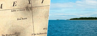
If you ask someone about the islands they have visited, their answers can vary significantly. They may have visited one, several, or perhaps none. However, let’s consider the last scenario seriously. Although you might think you have never set foot on an island, the story that follows will reveal that you may have been to one (or multiple times). This island is called Null Island, and its paradox is that you will only find it on maps.
The Island is Not an Island
In essence, when we refer to Null Island, we are referencing a cartographic location, rather than a tangible landmass. This unique spot is defined by zero degrees latitude and zero degrees longitude. In other words, it marks the intersection where the first Earth meridian meets the Equator. To be more precise, it is a point located in the Gulf of Guinea, which lies off the western coast of Africa in the eastern tropical Atlantic Ocean.
The Reason for Its Existence
The existence of a reference point for geolocation stems from a necessity: to have a starting point (or 0-0 location) from which various other points can be plotted. This particular location was intentionally chosen to mark the intersection between the Equator and the Prime Meridian. This is fundamentally linked to the World Geodetic System 1984 (WGS 84)—the standard framework that underpins GPS technology.
Why the Gulf of Guinea
The Gulf of Guinea is part of the South Atlantic Ocean, situated at a critical geographical juncture: it is where Western Africa bends southward, transitioning into central Africa. This strategic location places the Gulf at the center of any standard world map—something that is no mere coincidence. It serves as the meeting point for the two essential geodetic measurement lines: the Prime Meridian and the Equator. To specify, we are discussing the coordinates 0° N, 0° E.
This is precisely what Null Island represents—the perfect anchor for data that is not geolocated. However, as you may have surmised, it is not a conventional island. Instead, it colloquially describes the intersection of these two major orthodromes. In mathematical terms, an orthodrome (or great circle) is essentially the longest line that can be drawn around a sphere, dividing it into two equal hemispheres.
It Is a Buoy
This is not a joke: there is no real continent where you might expect to find an island. However, if you venture into the Gulf of Guinea and head towards the intersection of the Prime Meridian and the Equator, you will encounter a large buoy. This buoy represents the closest thing to Null Island that exists in our physical world.
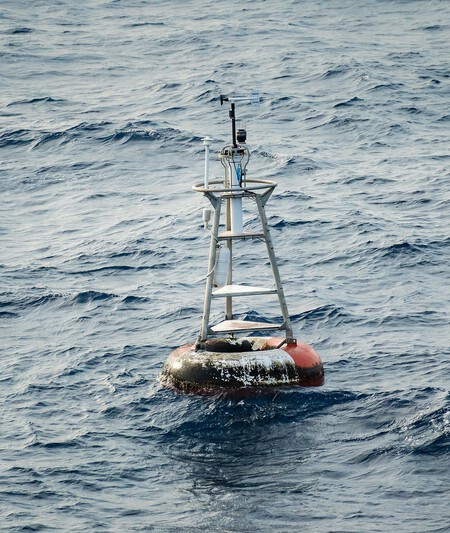
Null Island (also known as La Boya Station 13010 – Soul)
Commonly referred to as Station 13010 – Soul, this buoy serves as a climate monitoring station that is integral to prediction and research systems focusing on the Atlantic. Along with 16 other buoys, it measures essential data such as wind speed, air temperature, and humidity, all of which are crucial for meteorological averages and climate models.
So in the real world, Null Island is a buoy, while in the virtual realm, it serves as a hypothetical point where misaligned data points are tracked.
The Origin of the (No) Island
Geographically, the Equator is equidistant from the poles, dividing the Earth into northern and southern hemispheres. In contrast, the Greenwich Meridian—although the first meridian—was only established as such in 1884 during the International Meridian Conference in Washington, D.C. The French chose not to vote in favor of it, advocating instead for the Paris meridian.
That year marked the creation of our now well-known point at 0° N and 0° E. This location remained culturally insignificant until 2011 when it appeared as “Null Island” in the public domain map data set provided by Natural Earth.
As explained in a statement from Natural Earth: “We have added a debugging country for errors with an indeterminate sovereignty class called Null Island. It is a fictitious island, occupying a square meter, which lies off the coast of Africa, where the Equator and the Prime Meridian intersect. It was implemented to help pinpoint geocoding errors that display as 0.0 in many services.”
Why You Have Been There
You have likely stumbled upon Null Island more times than you realize, often while incorrectly searching for a location. While there is no actual Null Island, it serves as a convenient placeholder for frequent errors in mapping data. These “zero-zero readings” often arise from data gaps or software glitches.
Ultimately, it’s the essential GPS technology we rely upon daily that has inadvertently guided us to Null Island. When searches yield no results, or when a system failure occurs, the location is rerouted to this conceptual point at 0° latitude and 0° longitude.
Image | Graham Curran
In Xataka | This is the life on the most remote inhabited island: the improbable history of Tristán de Acuña.
In Xataka | In Japan, an island has just emerged unexpectedly. Of course, we have the video.
*An earlier version of this article was published in July 2024.