
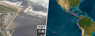
The earthquake of magnitude 8.8 recorded this morning on the Kamchatka Peninsula has reminded many of the earthquake and subsequent tsunami that devastated a segment of the Japanese western coast in 2011 . However, to find a precedent closer to the recent event, we must go back to November of year 1952 .
Some precedents. Specifically to November 4, 1952, at 18:58, Spanish peninsular time — 3:58 am in the Kamchatka Peninsula. It is estimated that this day, the failure that separates the Pacific and North American
plates slid, generating an earthquake of magnitude 9.0 (it must be taken into account that the logarithmic nature of the scale implies that the difference between both events could be remarkable).
The event that happened almost 73 years ago is maintained as the largest earthquake recorded in the region, although the archives of the United States Geological Service (USGS) also highlight an earthquake that occurred in 1923 that reached magnitude 8.4 .
Both the today’s earthquake and the 1952 earthquake had their OSONRO EPICENTERS (at a distance of only 30 kilometers from each other). This is unlike the one that occurred in 1923 , whose epicenter was located off the coast of the Peninsula.
The consequences of an earthquake. The 1952 earthquake was not only the largest recorded in the region; it was also the fifth largest earthquake measured by the instruments of geologists. This event unleashed a powerful tsunami with waves measuring up to 12 meters , captured on the nearby Paramushir Island .
The NCEI records (National Centers for Environmental Information), which is responsible for preserving data and geophysical information of US institutions , indicate that the 1952 event resulted in the loss of between 4,000 and 14,000 lives , with estimates placing the number at around 10,000 deaths .
Despite its magnitude, there is no direct record of damage caused by the earth movement itself. As with other occasions, it was the subsequent tsunami that wreaked havoc; estimates by the NCEI suggest that 99% of the victims died as a result of the tsunami.
More than earthquakes. Kamchatka is a geologically active region . Within the environment where the earthquakes of 1952 and this year occurred, the Pacific plate moves in a west-northwest direction at a speed of about 80 mm per year with respect to the North American plate . This implies that between the two earthquakes, the plates moved approximately six meters , as the USGS has highlighted.
Evidence of the geological activity of the region is found in the numerous volcanoes located on the Peninsula. The volcanoes in the area are still active, as demonstrated during the last incident. Furthermore, they make up an interesting ecosystem that led UNESCO to include them in its list of World Heritage Sites .
In Xataka , the issue of tsunami preparedness, especially in countries like Japan , is crucial, highlighting that they have had decades of advantage in disaster readiness.
Understanding the seismic activity and implications of such massive earthquakes is vital in preparing communities for future events. Historical precedents like the 1952 Kamchatka earthquake serve as reminders of the raw power of nature and the importance of implementing effective disaster response measures . As we witness more seismic events, the focus on research, preparedness, and resilience in vulnerable regions becomes more urgent. The balance between respecting nature’s fury and ensuring human safety is a challenge that societies must continually navigate.