
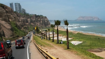
The recent emergence of the sun in Lima has taken many citizens by surprise. In the lead-up to winter, when overcast skies and low temperatures are typical, Lima residents have witnessed two consecutive days of bright sunshine and a slight increase in temperatures. This unusual behavior has raised questions about its duration and implications for the upcoming days.
In districts such as La Molina , temperatures hit 25°C , a figure that is quite rare this time of year. Many people stopped wearing jackets during the day, although others remained cautious due to the characteristic thermal drop associated with June. The stark contrast between the cold air and clear skies has captured the attention of residents and specialists alike.
As a result, all eyes are now on the weather forecast for the following days. While mornings continue to report little cloudiness, the National Service of Meteorology and Hydrology (*Senamhi*) has already issued reports clarifying what the weather will hold for Lima in the remaining week.
Recent sunny conditions observed in Lima and Callao are attributed to the presence of warm winds coming from the north of the country. David Garay, a meteorology specialist from Senamhi, explained that these winds have significantly reduced cloud cover, allowing for a temporary rise in maximum temperatures.
Garay warned that this phenomenon is merely temporary . Over the next few days, a gradual decrease in maximum temperatures is expected, with records possibly dropping to 22°C or even lower. This change will be associated with the arrival of winds from the south and an atmospheric system that favors cooling.
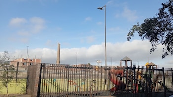
The expert reminded us that these episodes of sunshine do not eliminate the cold air present in the capital. The variability of the climate along the Peruvian coast allows for certain moments of clear skies, but the overall conditions remain aligned with the onset of winter , officially starting on June 20 .
“The sunny days are part of the coastal variability; however, we still have low temperatures, the air remains cold, and values are low due to the approach of winter, which officially begins on June 20,” stated Garay in an interview with *Canal N*. He added that the sky over Lima will likely return to a cloudier condition due to a change in wind direction.
Thus, while some districts may continue to record temperatures above average for several hours, the return of cold, cloudy weather is imminent , signaling gray days and low thermal sensations across much of Metropolitan Lima.
The last two days have been characterized by an unusual sunny episode in Lima . Although conditions have not been as muggy as in summer, the thermal sensation increased noticeably, catching many Lima residents off guard, who are accustomed to overcast skies and high humidity during this season.
On June 11 , meteorological stations in Lima and Callao reported one of the warmest days of the year. Specifically, the Callao station recorded a maximum temperature of 25°C , a level not seen in June since 2023. This temperature is linked to the sparse cloud cover and warming of the sea surface along the central coast.
Abraham Levy, known as the ‘ weather man ’, noted that this temperature is the third highest ever recorded in Lima on June 11, only surpassed by 26.4°C in 1997 and 27.8°C in 1983, both during the El Niño phenomenon. The historic average for this date, from 1980 to 2024, is 20.05°C .
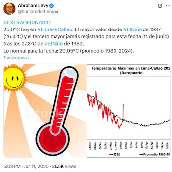
On June 12 , Levy reported that Lima woke up yet again with mostly clear skies. He forecasted maximum temperatures of between 21°C and 23°C across various districts in Lima and Callao.
Senamhi has issued a weather notice due to the increase in winds along the Peruvian coast , effective from June 11 to June 13 . This phenomenon will impact regions including Lima, Callao, Ica, Áncash, La Libertad, Arequipa, Piura, Lambayeque, and Tumbes .
The increase in wind speed, which will shift from light to moderate intensity, may lead to the raising of dust or sand in exposed areas. A reduction in horizontal visibility is also expected, particularly in coastal zones and open spaces.
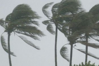
Furthermore, the increase in southern winds will bring greater cloud coverage , fog or mist formation, and scattered drizzle, particularly during early mornings. These conditions will heighten the feeling of cold and contribute to another drop in temperatures.
Although the presence of sun rays is not entirely ruled out in districts remote from the coast, the majority of Lima is expected to return to a cloudy state in the coming days. Senamhi advises the public to stay informed and take precautions against sudden changes in weather conditions.