
Weather Overview for the Week
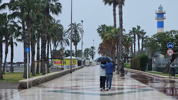
This week is characterized by marked meteorological instability and a decidedly chilly atmosphere atypical for May. An advancing Atlantic storm will mainly affect the northern and western regions of the peninsula, bringing with it rain and cooler temperatures. According to the State Meteorological Agency (Aemet), expect temperatures to remain between five and ten degrees below seasonal norms, along with potential snowfall in mountainous areas and widespread showers.
Monday: Rain and Cool Temperatures
Start the week with overcast skies and intermittent showers across regions such as Galicia, the Cantabrian Sea, Castilla y León, and northern Extremadura. There’s a chance for storms and snowfall in high-altitude areas. While temperatures are persistently low in the interior regions, the Mediterranean coast may still witness mild temps exceeding 25 degrees.
Tuesday: Escalating Instability
On Tuesday, the instability will worsen. Expect cloudy skies to dominate much of the peninsula, with precipitation expected especially in the northern half and central regions. Anticipate heavy showers, storms, hail, and potential snowfall in the Pyrenees. Maximum temperatures will struggle to reach above twenty degrees in the north and center, while regions like Murcia may see highs around twenty-seven degrees.
Wednesday: Intensifying Cold
Wednesday will bring an intensification of the north wind, heightening the sensation of cold across the region. The afternoon could see the development of scattered, strong showers, particularly around the Pyrenees and Balearic Islands. In the northeast, temperatures could fall below fifteen degrees in cities like Pamplona, Vitoria, and Burgos.
Thursday: Continued Precipitation and Temperatures Below Average
Thursday mirrors Wednesday’s chilly conditions, with ongoing precipitation and snowfall reported in the Pyrenees, as the snow level decreases progressively. Expect not only cold but also a constant feeling of chill driven by the north wind. Cities such as Lugo, Pamplona, or Vitoria may barely reach fifteen degrees, with early morning temperatures dipping to as low as two or three degrees in places like Soria or Teruel.

Friday and Weekend: A Winter Peek
As we transition into the weekend, a winter atmosphere will settle in, featuring potential frosts in elevated regions and maximum temperatures remaining below fifteen degrees in the northern and eastern interior. Rainfall will be confined to the far north and the Balearic Islands. While temperatures may gradually rise on Saturday, the overarching cold conditions will persist.
Canary Islands: Stable Yet Cloudy Climate
In the Canary Islands, the week starts off with intervals of clouds and potential scattered rains on the most significant islands. Midweek growth in cloud cover is likely due to a north wind bringing rain to the northern mountainous regions. While temperatures remain relatively stable, expect minimums between seventeen and nineteen degrees, and maximum temperatures ranging from twenty-three to twenty-five degrees in coastal areas.