

Revisiting Cádiz: The Transformational Power of Cartography
Geography often feels like a frozen tableau, seemingly unchanged by the swift passage of time. However, cartographic science offers a fascinating peek into our past, revealing the dynamic nature of our landscapes. One striking example of this evolution is the Bay of Cádiz in Spain, a region that has undergone remarkable transformations over the last few centuries. The key to this understanding lies in a scientifically rigorous nautical chart from 1789, which serves as a historical benchmark.
Historical Insights: The Map of Cádiz
While we may not possess a time machine, historical documents can serve as powerful windows into the past. One such document is the meticulously crafted nautical chart of Cádiz, which captures the essence of this region over 230 years ago. This document provides an almost cinematic glimpse into the coastlines, waters, and structures that once defined the area.
The Enlightenment Era and Cartographic Accuracy
To truly understand the significance of this nautical chart, we must revisit the period between 1783 and 1788. During the Enlightenment’s drive for knowledge, the necessity to control vital Atlantic shipping routes prompted a shift from rough estimates to scientifically rigorous maps. Leading this charge was Brigadier Vicente Tofiño de San Miguel, then director of the Marine Guard Academies, who created the Maritime Atlas of Spain. The Cádiz map, one of 47 plates in this atlas, illustrates the sophisticated engineering of its time.
A Cartographic Masterpiece
Crafted by the cartographer Felipe Bauzá and engraved by Fernando Selma, the map measures 56.5 x 87 cm and exhibits the coastline from Rota to the Sancti Petri river at a scale of 1:30,000. This nautical chart is not just visually impressive; it contains invaluable data, including precise placenames, the locations of historic salt mines, military arsenals, and even bathymetric details. This wealth of information helps researchers analyze how the land has evolved over generations.
The Threat of Sedimentation
Since 1726, sediment accumulation has plagued maritime traffic in Cádiz, a problem that continues today. By comparing historical maps with modern ones, we see how changing currents and river mouths have altered the bay’s natural draft. These changes have necessitated the reconfiguration of port areas, illustrating the ongoing battle against nature.
From Salt Flats to Urban Expansion
The map of 1789 depicts an extensive network of salt mines, a cornerstone of the local economy as salt was of immense value. Unfortunately, urban expansion and industrialization have obliterated many of these historical landscapes, replacing them with bustling cities like Puerto Real.
The Shifting Coastal Profile
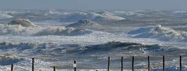
Comparative studies between past and present reveal that the coastline of Cádiz has both advanced and receded. Former estuaries and marshes have been transformed into dry land and port infrastructures, highlighting human impact on the environment.
Access to Historical Data
Fortunately, this treasure of cartographic history is no longer relegated to museum displays. The National Geographic Institute has made the map available for download here. This accessibility empowers researchers to delve into the historical and geographical shifts that have shaped Cádiz over the centuries.
Images | Nerea Garcia IGN