
All eyes are on the Strait of Hormuz, a critical chokepoint through which 20% of the world’s oil passes. However, chaos reigns in this narrow corridor, measuring just 33 kilometers, and a significant factor complicating matters further is the failure of GPS systems. This issue is not isolated; it is becoming increasingly prevalent, with ramifications that extend far beyond the conflict itself.
Chaos in Hormuz
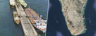
According to reports from the BBC, there are countless ships navigating the Strait of Hormuz area, yet their GPS location systems are displaying erroneous positions. Some vessels appear to be stacked on top of each other or forming impossible shapes on Earth. This distortion is due to interference from GPS inhibitors, which heightens the risk of maritime collisions—especially detrimental in conditions of low visibility.
The Purpose of Confusion
GPS signal inhibitors are not just a nuisance; they have evolved into a critical tool in modern warfare. A comprehensive report from the Wall Street Journal reveals that these devices are prominently used in conflict zones like Ukraine and Iran, as illustrated in this interactive map. Their primary function is to compromise drones and guided munitions, essentially rendering them ineffective.
Demonstrated Efficacy
Evidence from the ongoing conflict in Ukraine highlights the effectiveness of these systems. A detailed report submitted to the U.S. Department of Defense noted that the accuracy of Excalibur artillery plummeted from 70% to a mere 6% within weeks due to Russian advancements in electronic warfare, specifically through the deployment of GPS jammers. These devices are often compact and affordable, making them easily accessible for field use.
Consequences of GPS Interference
In 2024, an incident involving an American Airlines flight flying over Pakistan alarmingly triggered a “pull up” warning, despite the aircraft being at a safe altitude of 32,000 feet. The cause? GPS interference. Similarly, in April of that year, Finnair temporarily suspended flights to Tartu due to Russian jamming activities. The aviation sector heavily relies on GPS, and these interferences sometimes lead to serious errors. For instance, a flight carrying Ursula Von Der Leyen had to divert unexpectedly due to suspected GPS disruptions.
The Cracks in GPS
The Global Positioning System (GPS) is a satellite navigation system established by the United States in the 1960s, initially for military applications. Over the decades, it has become integral to various sectors, including the digital economy. While several satellite systems exist—GLONASS (Russia), BeiDou (China), and Galileo (Europe)—GPS remains the most widely used globally.
Implications of Dependency
Our reliance on GPS means that any signal degradation can have cascading effects on many essential services. Signals from satellites travel roughly 20,000 kilometers, ultimately arriving at a weak strength, making them highly susceptible to disruption.
Searching for Solutions
The vulnerabilities of GPS systems underscore the pressing need for more robust alternatives, particularly in aviation. Inertial navigation systems (INS), utilizing gyroscopes and accelerometers, are already deployed in aerospace, defense, and autonomous vehicles. Additionally, innovative technologies are emerging, including systems that integrate quantum sensors aligned with the Earth’s magnetic field and AI algorithms designed to interpret terrain features.
The Future of Navigation
Despite its shortcomings, GPS remains unrivaled due to its widespread availability and precision. While not all areas are adequately covered by emerging systems, the general trend points toward a multi-source approach to mitigate the limitations of any single navigation system.
For those interested in the evolving landscape of navigation technology and its implications, keeping abreast of advancements in the field is crucial.