
Unprecedented Occurrences: Starlink Satellites Photobombing Earth Observation Images
Until recently, the notion that a terrestrial observation satellite could accidentally capture another satellite during its flight seemed almost far-fetched—akin to discovering a needle in a haystack. Space is a vast expanse, and satellites move at incredible speeds. Yet, in the last year, we’ve witnessed this phenomenon twice, with a recurring protagonist : the SpaceX Starlink satellite.
History-Making Images Over a Military Base
On August 21, 2022, a new WorldView Legion satellite from Maxar passed over the Gobi Desert in China. Its mission was to photograph the Dingxin Air Base , a secretive site where China tests some of its most advanced fighters. However, the satellite image revealed an unexpected intruder that caught the attention of both professionals and enthusiasts alike.
A metallic spacecraft, identified as a Starlink satellite , crossed Maxar’s photo, adorned with two large solar panels and displaying a spectrum of colors. An executive from Maxar aptly referred to this occurrence as “accidental art” in a LinkedIn post. What viewers see is actually a single satellite— Starlink 33828 —captured in multiple wavelength bands over one of the most sensitive locations in the Chinese military’s operations.
Understanding the Optical Illusion
The curious multicolored image arises from the intricate functioning of observation satellites and their extraordinary speed in orbit. Rather than capturing a single image , these satellites acquire a series of images across various spectral bands almost simultaneously: one high-resolution (panchromatic) image and several lower-quality images in different color spectrums (red, green, blue, etc.). An algorithm then merges this information to produce a cohesive final photograph.
The challenge comes with the term “almost simultaneously.” When the target is the Earth—relatively static concerning the satellite—the system functions seamlessly. However, if another satellite enters the camera’s field of vision, traveling at nearly 1,400 meters per second (approximately 5,000 km/h), it will appear in different positions across the various color layers. This effect creates the peculiar spectral distortion seen in the images.
Starlink’s Google Maps Debut
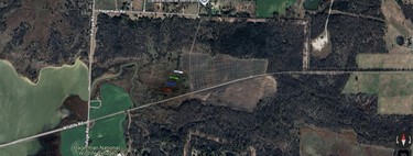
This is not the first time a Starlink satellite has intruded upon an unrelated photograph. In April 2022, a user on Reddit discovered a similar phenomenon in a Google Maps image taken over a rural area in Texas. In that instance, a Pleiades European satellite captured the image, producing even clearer results, with five silhouettes of the same object visible, corresponding to different spectral bands: close, red, blue, green, and panchromatic infrared. The sheer number of satellites in low Earth orbit is transitioning what was once an extraordinarily rare event into a new normal .
The Dominance of Starlink Satellites
But why are Starlink satellites so frequently involved in these sightings? The answer lies in their dominance. SpaceX has already launched more than 8,300 Starlink satellites , exceeding the total number of satellites from all other constellations combined. With plans to expand the network to over 30,000 satellites , the chances of one of these crossing paths with another observation satellite are steadily increasing.
Moreover, Starlink satellites operate at about 500 km altitude , which is relatively low. This altitude places them on the same orbital “highway” that many Earth observation satellites, such as the WorldView Legion from Maxar, also use (positioned at 518 km). Consequently, their paths are destined to intersect.
The Growing Congestion in Low Earth Orbit
Beyond the striking visuals and anecdotes, these images signal a concerning trend: the congestion of low Earth orbit is becoming increasingly apparent. The mounting number of satellites necessitates frequent evasion maneuvers to prevent potential collisions, raising questions about space traffic management and the long-term sustainability of satellite operations.
As our reliance on satellites intensifies, understanding the implications of these encounters becomes vital. The accidental layers of insight these images provide remind us of the complexities involved in both space exploration and the burgeoning growth of satellite technology.