
Let’s tell you How To Follow the State of Fires with all the information, and also see them on the map. In this way, if you have a fire near your location or if you just want to stay informed, you will have the best ways to do it.
We will start by detailing how to track the evolution of these events using fire maps, which can show you their current status in real time. Then, we will discuss some additional sources where you can find all the necessary information.
Look at the Fires on Google Maps
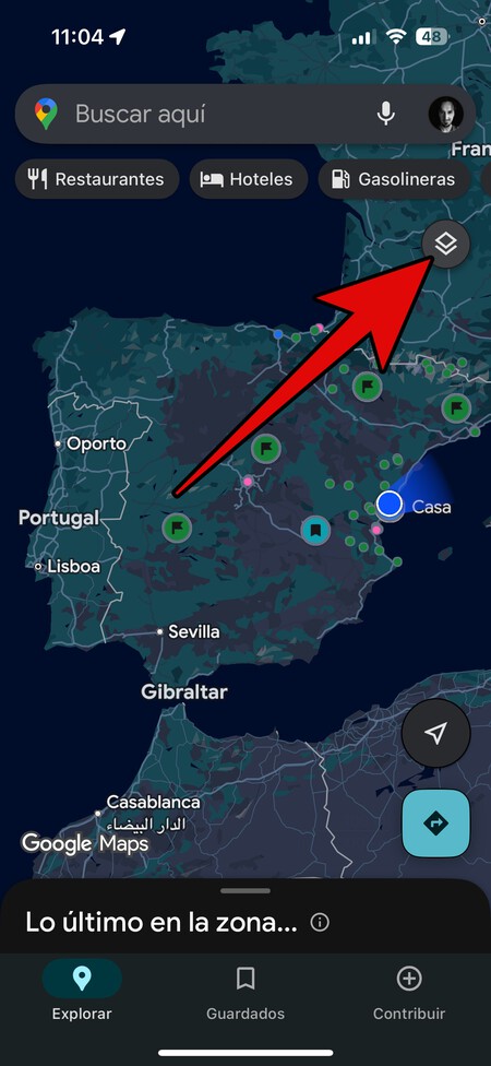
You can look at active fires and information about them on Google Maps. To do this, on the main screen, click on the layer button or maps, which appears with the icon of two overlapping squares.
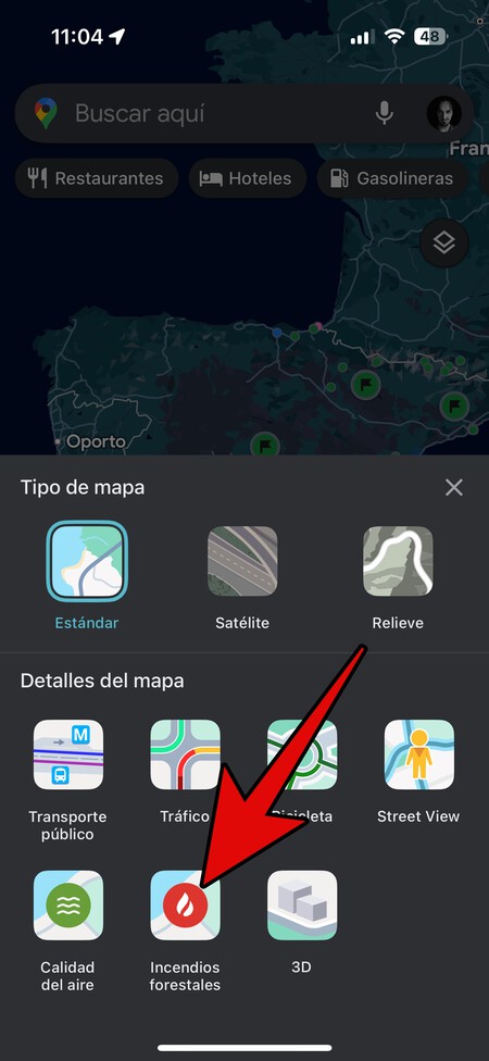
This will open a screen where you can choose from several types of maps to visualize. On this screen, click on the map of Forest Fires that appears with the icon of a flame.
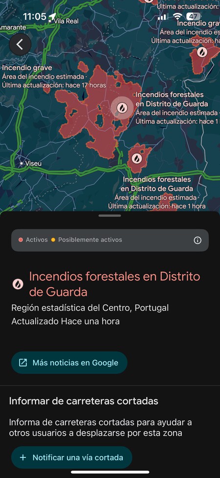
This will take you to a maps screen where all active fires will appear in red. You can click on the icon of any of the fires, and a page will open with all the information, including the size of the fire in red, along with links to access news or information on any road closures in the area.
NASA Fire Map
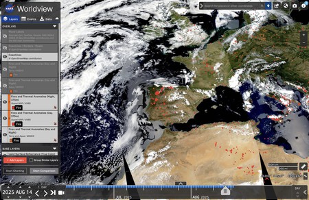
An alternative tool is NASA’s fire map. To view it, visit WorldView.earthdata.nasa.gov, where you can activate the filter to display fires from around the world on the left side.
This map may appear confusing, but you can select a specific date, and then the fire map from that specific day will be shown worldwide, allowing you to navigate and zoom into specific areas.
Keep in mind that the map is not updated in real time, but it captures data globally every day, enabling you to track the evolution of fires in an area and even create animations of their progression.

Other Pages for Current Fire Information
Now, let’s explore additional websites where you can access updated information about fires occurring in Spain. This way, you can keep track of the latest developments that interest you the most or follow every incident in general.
- Copernicus System: Copernicus is the European Forest Fire Information System, offering a map where you can visualize all active fires in Europe. This visualization can be activated in the left column. Link: forest-fire.emergency.copernicus.eu/apps/effis_current_situation/index.html
- Online Newspapers: Most newspapers in Spain have launched dedicated sections in their online versions featuring the latest news on fires. Notable examples include El Diario, Onda Cero, and El País.
- Civio Fire Map: This page aggregates information on all past fires, illustrating it on a map so you can visualize the total area affected over time. Each point denotes a fire, and hovering over it presents all relevant information. Link: civio.es/medio-ambiente/mapa-de-incendios-forestales/.
- Official Statistics: Additionally, you can access the Historical Statistics page from the Ministry for Ecological Transition and the Demographic Challenge, where all kinds of fire statistics dating back to the late 1960s are available. Link: miteco.gob.es/es/biodiversidad/temas/incendios-forestales/estadisticas-datos.html.
Staying updated on forest fires is crucial for safety and awareness. By utilizing these tools, you can monitor the situation effectively, ensuring you’re well-informed and prepared in case of emergencies.