
Although the heat wave that has enveloped Spain for days is beginning to wane, as noted by the State Meteorology Agency (AEMET), the situation remains dire with forest fires still raging across the country.
This year, over 344,400 hectares have burned in Spain. This unfortunate milestone makes 2025 one of the worst years for forest fires in Europe in the last two decades.
Given the escalating situation, many are understandably concerned about the evolving fires. The reality is that the fire outbreaks are continuously shifting. Nevertheless, there are technological tools that provide open and accessible information to both the public and authorities.
Among the most effective resources are the Google Maps crisis alert system and the emergency viewfinder from the Copernicus Program of the European Union. These tools are available for free, enabling users to monitor the evolving situations in real time.
Fire Outbreaks in Spain
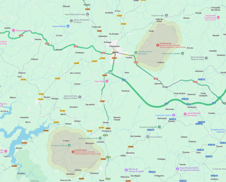
Mellid Deza and Land Fire Outbreaks
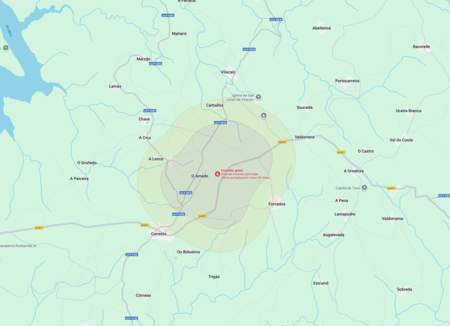
Focus in Limos Land
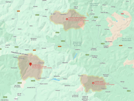
Fire Outbreaks in El Bierzo, Asturias and Villablino
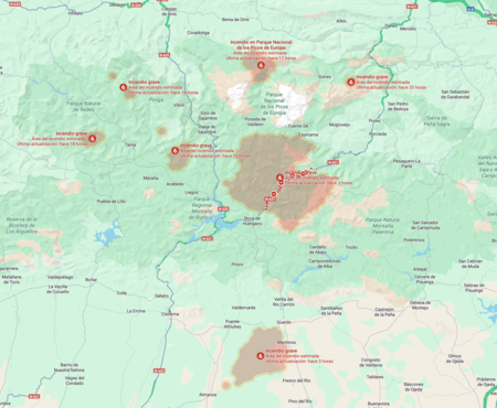
Fire Outbreaks in Valle del Nalón, Boñar-Cistierna, Asturias
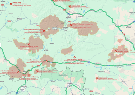
Fire Outbreaks in Ourense and Surroundings
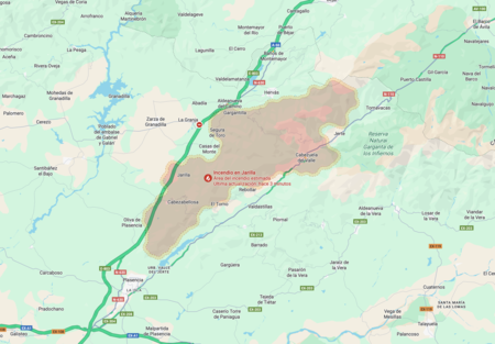
Focus in Extremadura
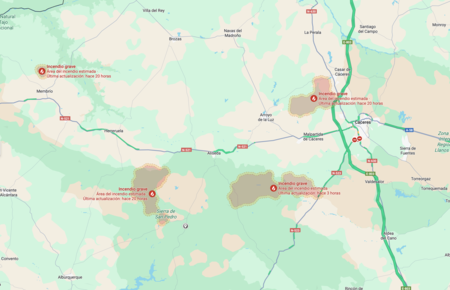
Focus in Cáceres and Surroundings

Fire Outbreaks in León and Surroundings
How to See Active Forest Fires on Google Maps
Google Maps is a commonly used application, yet many users remain unaware of its full capabilities. To view active forest fires , open the mobile app or visit maps.google.com and click on the layer icon located in the upper right corner.
In the Map type section, no changes are needed. Instead, navigate to the Map details section and select the Forest Fire option.
The system will display affected areas along with crucial information, such as the severity and the date of the latest update. Clicking on any marked area, such as Ourense, allows users to access detailed information including the estimated perimeter and links to official sources and related articles.
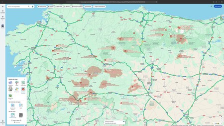
Google Maps goes beyond merely marking locations; it incorporates AI and satellite imagery to effectively identify and define forest fires. This uses a Deep Learning model trained with satellite data from sources like GOES-16, GOES-18, and Himawari-9, among others.
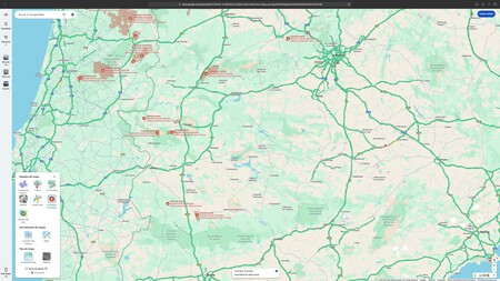
Moreover, it relies on sensors such as MODIS (from the Aqua and Terra satellites) and VIIRS (aboard the Suomi NPP and JPSS-1 satellites). This wealth of data is processed using superresolution techniques to accurately identify active hotspots and update maps promptly.
How to Consult Active Forest Fires in Copernicus
For users interested in the Copernicus system, access it via the Current Situation Viewer available at forest-fire.emergency.copernicus.eu/applications.
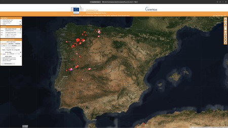
The viewer is quite user-friendly. On the left side, locate the Rapid Damage Assessment section and select the Active Fire layer.
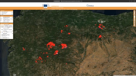
There are two selectable data sources:
- MODIS: Collects information through satellite sensors Terra and Aqua .
- VIIRS: Uses similar algorithms to detect active hotspots aboard the satellite Suomi NPP (National Polar-Orbiting Partnership).
These layers allow users to visualize the forest fires detected from space in real-time, making them invaluable for monitoring the situation both in Spain and across Europe.
Images | Copernicus (Emergency Management Service) | Google Maps
In Xataka | If the question is how to shield the mountains from fires, in Soria they have an ancestral solution: luck of pines.