
The Arrival of Storm Benjamin: Spain Braces for Extreme Weather
As the day draws to a close, Spain prepares for the first major storm of the season, aptly named Storm Benjamin . Currently, the Cantabrian Sea is experiencing violent waves and powerful gusts, signaling the storm’s imminent impact. However, this is just the beginning of the tumultuous weather. Following Storm Benjamin, a substantial river of humidity is set to enhance precipitation levels starting Saturday, shifting the focus of weather disturbances to the Mediterranean by Sunday. Meanwhile, meteorological agencies across Europe are closely monitoring developments in the Bay of Biscay, where a bombogenesis threat looms, potentially causing upheaval across the continent.
Let’s break down what’s to come step by step.
A Timeline of Weather Events
Here’s a chronology detailing the anticipated impacts of Storm Benjamin:
- Thursday, October 23: The storm reaches its peak, with intense maritime conditions and strong winds hitting the Cantabrian Sea . The AEMET has issued a red warning for affected areas. Expect an increase in rainfall across Galicia and northern regions as the storm progresses into the evening.
- Friday, October 24: As the storm begins its journey towards Scandinavia , a new humidity front connected to the Gulf of Mexico will begin to approach Spain. This influx of moisture is expected to further exacerbate rainfall.
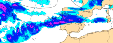
- Saturday, October 25: The arrival of this moisture will activate storm fronts near Spain, leading to locally strong and persistent showers in the central, western, and northern parts of the country.
- Sunday, October 26: As the stormfronts make their way to the Mediterranean, residents should prepare for a noticeable drop in temperatures, a spike in rainfall , and potentially the first snowfalls of the season.
Understanding Bombogenesis
So, what exactly is bombogenesis ? It’s another term for ‘ explosive cyclogenesis ,’ referring to the rapid formation of a storm or cyclone within a short time frame. In technical terms , we are discussing a dramatic intensification of an extratropical storm, characterized by a pressure drop of more than 24 hPa within a 24-hour window at mid-latitudes.
Is this what we can anticipate? Currently, meteorological models indicate that the bombogenesis may be centered north, somewhere between the Bay of Biscay , the English Channel , and the North Sea . The core of this intense system appears to remain distant from Spanish shores, but its fronts will inevitably affect local conditions.
While various forecasts point to a potential spread of the bombogenesis effect throughout Europe, autumn is notoriously unpredictable. The transitional nature of this season means weather patterns can shift rapidly, leaving room for surprises.
The Weather Party Begins!
Once these initial weather events transpire, the situation will only become more intricate. While longer-term forecasts delve into speculation, there’s a possibility that multiple Atlantic storms could pivot through this breach in prevailing weather patterns. As such, it would be wise for residents to remain vigilant and prepared for further changes.
Spain is on the brink of experiencing its first significant storm of the season, and as meteorological agencies warn, the effects of Judith may be just the beginning. Keeping an eye on developing weather models will be paramount in the upcoming days. Those in the affected areas should remain informed, prepare for drastic conditions, and stay safe. As the storm fronts approach, it is essential to acknowledge the power of nature and remain cautious.