
Understanding Spain’s Meteorological Dynamics: Postbile Dana and Thermal Extremes
In recent weeks, Spain has experienced a roller coaster of temperatures, marked by periods of extreme heat followed by temporary thermal relief brought on by weather phenomena like vaguades (or troughs). Starting at the end of June and continuing into July, the country faced intense heat waves interspersed with stormy weather, including hail and high winds. However, the balance achieved during this unpredictable weather cycle seems to be shifting.
What is Postbile Dana?
The looming concern is the potential development of a DANA (Isolated Depression at High Levels) in the coming days. According to experts from Meteored, this phenomenon is expected to introduce more hailstorms and powerful winds across various regions in Spain.
Two Distinct Air Masses at Play
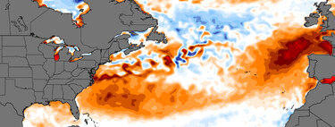
The forecast suggests that the onset of the DANA will occur in a notably different atmospheric context than what has been experienced throughout June. The current month displays a two-speed climate in Spain: the northern regions are under a cold air mass, while warm air dominates in the central and southern parts of the country. This unique scenario has led to a diverging temperature experience, where the northern Spanish territories have already experienced a moderation in temperatures, while southern areas continue to be gripped by the heat.
Gradual Thermal Relief
The much-anticipated thermal relief is emerging at different rates across the country: northern regions are feeling the effects sooner, with temperatures slowly descending from their previous extremes. Conversely, the southern half of Spain is lagging in this cooling process, with thermometers remaining stubbornly close to the 40ºC mark but beginning a gradual stabilization.
Upcoming Weather Uncertainty
As the DANA approaches, uncertainty plays a significant role in predicting impacts on the coming weekend. There are still questions regarding the trajectory of this weather system and how it will engage with the Iberian Peninsula. Forecast models indicate that we might see this weather front between Friday, July 11, and Sunday, July 13 .
Impending Storms and Hail
The anticipated arrival of the DANA presents a fluctuating graph of weather instability . If the transition occurs as forecasted, we may see a resurgence of severe storms, characterized by heavy rainfall and strong winds. According to the latest model predictions, Saturday is expected to be the day of notable disruptions, particularly impacting the northern third of Spain, northeastern territories, and parts of the Mediterranean coast.
A Summer Filled with Uncertainties
Looking ahead, the critical question arises: what changes will follow this week of relief? While recent warm spells have been offset by temporary drops in temperature, these cooling phases have generally been short-lived. However, the introduction of several troughs, including one closely associated with the anticipated DANA, could signal a more substantial and sustained decrease in temperatures. Based on current forecasts from the State Meteorology Agency (AEMET), Spain can still expect weeks that are hotter than average for this time of year—between 3⁄5 degrees above the norm.
Moreover, the quarterly forecasts from AEMET are projecting several more warm months ahead, with a 70% probability that conditions will remain atypically warm.
As meteorological events unfold, understanding these atmospheric dynamics becomes crucial for residents and authorities alike. Stay prepared and informed as we navigate through these unpredictable weather patterns.