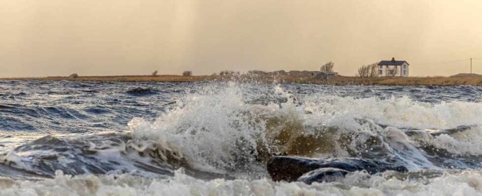
The Meteorological Institute first issued a yellow warning for strong gusts of wind along the coast of Nordland. On Tuesday morning, the meteorologist has upgraded the danger warning to orange level. – It is because the forecasts are more certain, and they have taken up in the areas where danger warnings had already been sent, says on-duty meteorologist Marek Ratajczak to news. – Then we ended up with such strong winds that you get a strong storm on the coast, and there are such strong gusts that it can cause damage, he continues. Lofoten, Vesterålen and Salten are expected to receive the strongest winds. Orange area: Gusts of 35–43 m/s from the northwest and west. Yellow area: Wind gusts of 27–35 m/s from the northwest. Wind gusts of up to 35–43 meters per second are expected in Salten, Vesterålen and Lofoten on Tuesday. Illustration: Meteorological Institute The meteorologist says that the mean wind will be a strong storm and will come from the west and north-west. – But it is the gusts of wind that are the most damaging. They will vary slightly depending on how far out or in towards the coast you are. On the coast, there will be gusts of up to 43 meters per second, says the meteorologist. He says they haven’t had such strong winds since the extreme weather Ingunn in February. – But it will be one notch less than that time. The wind is expected to hit Lofoten, Salten and Vesterålen on Tuesday evening and last through the night. Illustration: Meteorological Institute The meteorologist is aware that loose objects should be secured, and that one should avoid staying in the most exposed places where the wind blows the worst. – In addition to wind, there will also be high waves at sea. So it is absolutely not recommended to seek out the storm right down by the lake. The wind decreases during the night into Wednesday and Wednesday morning. The Norwegian Meteorological Institute has sent out a list of recommendations to prepare for the storm: Recommendations in connection with the storm Secure all loose objects Close windows and doors tightly Ensure that gutters, scaffolding, aerials and tarpaulins are securely fastened Avoid traffic in exposed areas Calculate extra time for transport and driving Consider whether the journey is necessary Follow advice and check status from transport operators Check road announcements (175.no) The need for preparedness must be assessed continuously by emergency operators Show caution when traveling in the beach zone and on the sea Consider measures in advance to limit damage Sleet and rain In connection with the storm, a good deal of precipitation is also expected in the area. A yellow warning has already been issued for heavy snowfall over large parts of Nordland. This mainly applies to the mountain passes from 200 meters above sea level. The yellow warning about snow pike in Nordland. Photo: METEOROLOGICAL INSTITUTE Mountain crossings exposed in Finnmark Several ferries, fast boats and buses are canceled in Finnmark are closed due to the slippery route and places exposed to strong winds. Winter has come to Finnmark. Morten Fjellheim confirms that. He is a traffic operator at the road traffic center north. – It is windy throughout the county, strongest on the coast. Winter has come upon us, and it is also snowing. The combination of snow and wind can create challenges. According to the road traffic center, it is slippery on the roads in Finnmark, including on county road 98 Ifjordfjellet, E6 over the Senna land between Alta and Hammerfest. Photo: Statens Vegvesen He says all mountain passes in Finnmark will be exposed to strong gusts of wind, but that it looks like it will calm down during the day. According to the road traffic center, it is slippery on the roads in Finnmark, including on county road 98 Ifjordfjellet, E6 over the Senna land between Alta and Hammerfest. Illustration: Meteorological Institute The Meteorological Institute has issued an orange and yellow warning for heavy rain in parts of Western Norway from late Wednesday and Thursday. Middle and inner areas from Sunnmøre to Rogaland are particularly affected. There, 100–150 mm can fall within 24 hours. But outer areas will also get a lot of rain. Orange danger warning is sent out when the consequences will be extensive for many people, according to yr.no. – It happens approximately every ten years that we see the values we expect now. Having said that, we are moving towards a wetter climate, so we will see more of these events in the future, says on-duty meteorologist Julie Solsvik Vågane at the Meteorological Institute. The air masses originate from the far south in the Atlantic Ocean and contain a lot of water vapour. They are quickly transported up to our latitudes and are very similar to what is called an atmospheric river. Large parts of Western Norway can expect floods and landslides after large amounts of rainfall are expected from Wednesday evening. Photo: NVE The Norwegian Directorate of Waterways and Energy (NVE) has sent out a warning at orange level for the risk of landslides and landslides for parts of Møre & Romsdal, Vestland and Rogaland – In addition, there is a risk of flooding and closed roads when we send out such a warning notice. It may therefore be a good idea to check that there are no leaves or other things in the drains around the house, says Vågane. Thursday is also Halloween. But the Norwegian Meteorological Institute does not make recommendations on whether one should drop “tricks or tricks” in the areas most exposed to rain. – I think you have to consider that in each individual place. But without a doubt it will be a wet day, she says. Published 29/10/2024, at 07.35 Updated 29.10.2024, at 11.33
ttn-69
– It will certainly be fierce – news Nordland

