
## The Discovery of the Trebur-Astheim Canal
Recent archaeological findings have unveiled an astonishing aspect of Roman engineering hidden beneath an agricultural plain near the Rhine River in southwestern Germany. An interdisciplinary team from the Johannes Gutenberg University of Mainz, the Christian-Albrechts-University of Kiel, and the Hessen Monument Office discovered what was previously thought to be an abandoned channel. It turned out to be an ancient Roman canal measuring 15 meters in width and 2.5 meters in depth. This canal connected the Rhine to a small military fort known as the burgus of Trebur-Astheim.
### Significance of the Discovery
The Trebur-Astheim Canal is one of the few navigable canals identified north of the Alps from the Roman period and the Early Middle Ages. Its existence illustrates that the Roman Empire’s influence in Germania extended beyond mere military presence; it significantly transformed the local landscape. This finding challenges previous notions of how the Romans approached logistics and infrastructure in this region.
## The Infrastructure Advantage
The canal likely served as a central logistical hub, enabling cargo ships to dock and redistribute goods effectively. This infrastructure was crucial for supporting Roman troops and demonstrates the empire’s comprehensive planning strategies. The ability to transport resources efficiently showcased a remarkably advanced understanding of hydraulic engineering, rivaling their famous road networks.
### Historical Context
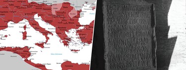
Roman occupation in the Hessische Ried began in the 1st century AD during the Flavian emperors. Constructed between 364 and 375 AD under Emperor Valentinian I, the fort of Trebur-Astheim was part of a broader strategy to guard against the Alamanni tribes situated on the Rhine’s right bank. The fortifications, including watchtowers, outlined a clear demarcation of the Rhineland border, now recognized on the UNESCO World Heritage List.
## Dimensions and Design
Trebur-Astheim essentially functioned as a protected inland port. Its dimensions are comparable to those of the Roman navigable canal Fossa Corbulonis, situated in present-day Netherlands. This made it suitable for various types of Roman river vessels, including the military type Mainz-A and cargo boats discovered near Xanten. The drafts of these vessels ranged from 0.35 to 0.65 meters, comfortably below the canal’s depth.
### Carbon Dating Insights
Carbon-14 analysis of the canal’s sediments indicates that it was actively in use from Roman times until around the 7th or 8th centuries AD, at which point it became obstructed with mud and was eventually abandoned. Despite the disuse, the structure underwent frequent dredging for centuries, with later Merovingian and Carolingian communities maintaining the canal.
## Challenges in Excavation
While the excavation conducted in 2024 provided vital insights, it wasn’t sufficient to access the canal’s walls due to the high water table and significant sediment. Consequently, estimations regarding the canal’s dimensions have been derived indirectly, a common practice in underwater archaeology. Future excavations are essential for obtaining direct data on the canal’s construction.
### Conclusion
The discovery of the Trebur-Astheim Canal not only adds a valuable dimension to our understanding of Roman engineering and infrastructure but also reshapes our perceptions of the impact of the Roman Empire in Germania. This ancient waterway exemplifies a sophisticated logistical network that went beyond mere military dominance, illustrating a profound understanding of hydraulic systems. As ongoing research unfolds, we may uncover even more secrets about this remarkable canal and its role in Roman history.