
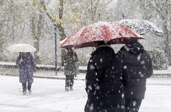
### Continuous Rain and Snowfall across the Peninsula
The upcoming weather forecast indicates continued rain affecting a significant portion of the Iberian Peninsula, particularly in the northern regions where snowfall is expected at low elevations. The State Meteorological Agency (Aemet) has issued warnings for severe frosts, especially in interior mountain areas, as a cold air mass lingers over the region, leading to substantial temperature drops.
### Temperature Drops and Frost Warnings
In the next few days, minimum temperatures are expected to plummet below freezing in several provincial capitals. Cities like Teruel could see temperatures dip to -5℃, while Huesca, Pamplona, and others may experience around -2℃. The activation of frost warnings reflects the harsh winter conditions, particularly in the northern and eastern parts of the Peninsula. These frigid temperatures coincide with heavy rainfall, which could exacerbate mobility challenges and outdoor activities across affected regions.
### Rainfall and Snow Level Forecasts
The weather forecast for Monday indicates widespread rainfall driven by the cold air mass and an incoming weather front that is likely to facilitate low-level snowfall. The snow level is expected to range between 800 and 1,000 meters in many areas, with some regions witnessing levels rising to 1,200 or 1,500 meters. Notably, the Pyrenees may experience occasional snowfall at lower levels, potentially leading to unusual weather conditions for this time of year.
### Regions Most Affected by Snow
Significant snowfall is projected primarily in communities like Asturias and Cantabria, as well as various provinces in Castilla y León, including Burgos and León. Additionally, parts of Catalonia, including Barcelona and Girona, are also at risk. While snow accumulation is expected to be light overall, isolated heavier episodes cannot be ruled out, particularly in higher altitude areas.
### Rainfall Impact Across the Peninsula
Despite a slight reduction in rainfall intensity compared to previous days, persistent precipitation is forecasted across most parts of the Peninsula. The western regions and the Atlantic coastline are set to receive the heaviest rainfall, while the Mediterranean regions will experience sporadic showers. Northern coasts are particularly susceptible to intense downpours at various times, as indicated by Aemet.
### Winds and Coastal Conditions
Wind patterns are predicted to vary by geographical area. The western interior and far northern parts are expected to see light winds, while coastal regions, including the Cantabrian Sea and the Gulf of Valencia, will experience moderate to strong winds from the west and northwest. This increases the likelihood of hazardous conditions, including strong gusts and high waves along the coasts, necessitating caution.
### Weather in the Canary Islands
In contrast, the Canary Islands are expected to see cloud cover and light localized rains, particularly in mountainous areas. Trade winds will blow moderately, with no significant temperature changes anticipated for the islanders.
### Ongoing Cold Snap and Weather Warnings
The predicted weather pattern foresees a continued cold snap, with widespread frost expected in the interior and mountainous regions, meaning travelers and outdoor enthusiasts should take appropriate precautions. Aemet continues to emphasize the need for vigilance due to the heightened risk of adverse weather conditions.
As we navigate this persistent winter weather, staying informed and prepared will be key to managing any impacts on daily activities and mobility across the affected regions.