
Severe Weather Alert: Mediterranean Storms Loom Over Catalonia and Valencia
This week, the weather is providing a brief reprieve from the scorching heat that has dominated the first half of summer. However, this relief comes with a significant risk of storms , particularly targeting the Mediterranean coast once more.
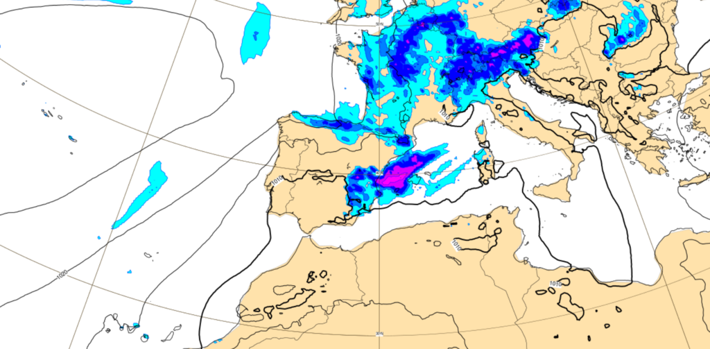
Storms Come Back. The advent of a new trough has prompted meteorologists to raise the alarm. This phenomenon poses the potential for significant storms across the Mediterranean basin, which could unleash hail and substantial flooding risks. In some areas, predictions suggest as much as 30 mm of rain could fall within the span of just one hour.
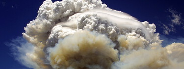
The Polar Jet and a Hot Mediterranean. Experts attribute the coming storms to the arrival of the trough , driven by an especially wavy polar jet during this period. These wave patterns are expected to introduce a mass of cold air high in the atmosphere. When this encounters the warmth of the Mediterranean, it fosters the development of convective clouds , which are ripe for storm formation.
The combination of two critical factors raises concerns regarding the upcoming weather conditions. First, the trough is described as being “anomalously intense for the time,” according to JJ German , a physicist and researcher at Aemet. Second, the Western Mediterranean Sea is sitting at temperatures significantly higher than what is typically expected this time of year.
“Clouds of fire,” the phenomenon that makes escape from sixth-generation fires can make it impossible.
As of Wednesday, anticipation grows as storms are expected to intensify, particularly during the days of Wednesday and the early hours of Thursday. Forecasts predict rainfall ranging between 30 and 40 mm in just one hour, with the possibility for even heavier precipitation, thus increasing the flood risk especially in the ravines and ramblas of the region.
Important Risk. The State Meteorology Agency (AEMET) has issued a series of alerts related to these storm episodes, which will complement existing warnings associated with the maximum summer temperatures. Currently, orange alerts are issued, indicating a significant risk on Wednesday, while more will depend on the evolution of the situation into Thursday.
On Wednesday, nearly all of Catalonia will be under storm and rain alerts. Similarly, areas such as the Aragonese and Navarro Pyrenees and parts of Aragon and the province of Castellón will also be affected. Regions in Girona , Barcelona , Tarragona , and Castellón will also face orange alerts due to elevated risk levels. Additionally, the risk of Rissagas —abrupt sea level changes—will add to the strain, especially on the island of Menorca .
Change in the Trend? Signs suggest improving conditions by Friday, although some intermittent instability may still linger in specific areas. Meteorological models indicate that after the storm passes, stability could return over the weekend, possibly ushering back in high temperatures . However, it remains essential to monitor the atmospheric situation closely as changes occur.
In the face of these brewing storms, local authorities are urging residents to stay updated and exercise caution. Weather unpredictability is a sustained feature of summer in the Mediterranean, and this recent shift serves as a reminder of nature’s relentless power and unpredictability.
The news is both a cautionary tale and a lens through which to appreciate the delicate balance of our climate. Understanding these meteorological patterns is paramount, not only for immediate safety but also for long-term adaptation strategies as we navigate the changeable world of modern weather phenomena.