
Weekend Weather Update
Thunderstorms and Severe Weather on the Horizon – Maps Show Where the Action Is
As the weekend approaches, the forecast indicates a dramatic shift in weather conditions across Germany. With the arrival of summer, residents can expect humid conditions on Saturday, followed by the threat of thunderstorms and severe weather starting in the afternoon. Understanding the upcoming weather patterns is crucial for planning safe outdoor activities.
Weekend Weather Overview
On Saturday, the weather will turn uncomfortable , particularly in the west and central parts of Germany. The German Weather Service (DWD) predicts intense thunderstorms beginning around midday, accompanied by heavy rain , possible hail, and gusty winds.
Regions at Risk for Severe Weather
Initially, areas including North Rhine-Westphalia , Rhineland-Palatinate , the Saarland , and Hesse will be heavily affected. Residents in these regions should prepare for potential severe weather conditions. As the evening progresses, the thunderstorms are expected to move eastward, impacting places as far as the eastern Bavarian low mountain ranges.
Start of Meteorological Summer
In the early hours of Sunday, meteorological summer will commence. However, calm weather will be short-lived as thunderstorms are forecasted to expand toward northeastern Germany and southern regions.
Expected Intensity of Thunderstorms
Especially on Sunday afternoon, regions located southeast of a line drawn from Hamburg to Stuttgart may experience severe weather, including heavy rain, strong winds, and larger-sized hail.
Interactive Weather Maps
The maps below illustrate the current weather situation:
Weather Map I: Live Thunderstorm Tracking
The interactive map below displays real-time weather conditions. The timeline at the bottom of the graphic allows users to view forecasts for various time frames. Users can toggle between different weather events, including thunderstorms, rain, or snow.
Weather Map II: Today’s Maximum Temperatures
The overview below shows the anticipated maximum temperatures for today.
Weather Map III: Tomorrow’s Maximum Temperatures
This overview displays the expected maximum temperatures for tomorrow.
Weather Map IV: UV Index Levels
The above map shows the expected UV exposure levels for today.
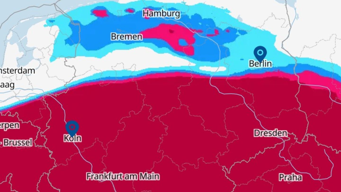
Weather Map V: Current Precipitation Types
The previous map illustrates the types of precipitation expected today in real-time.
Weather Map VI: Thunderstorm Warnings for Today
Displayed above are today’s thunderstorm warnings from the DWD. Places under warning are marked in red. No color indicates that there is no warning in place.
Safety Tips for Thunderstorms
Thunderstorm Safety Tips
The best protection during a thunderstorm is a solid building or an enclosed vehicle. In homes without lightning protection, it’s advisable to unplug electrical devices during storms.
If you are outdoors, find a ditch, a depression, a rocky overhang, or a concrete bridge to crouch under. Keep a safe distance from others and avoid any metal objects.
Do not seek shelter under tall trees during storms, as they attract lightning. If caught in a forest, crouch down for safety. Stay away from water, which is extremely dangerous.
If there is less than a 30-second delay between lightning and thunder, the storm is near—seek shelter immediately. Wait at least 30 minutes after the last lightning strike or thunder before resuming activities.
Weather Map VII: Thunderstorm Warnings for Tomorrow
This map shows tomorrow’s thunderstorm warnings. The red color indicates areas under warning, while no color shows areas without warnings.
The maps used in this article are sourced from wetter.de, an RTL Deutschland portal. Other maps incorporated here are from Windy.com, utilizing data from the European Centre for Medium-Range Weather Forecasts.
DPA
anb / rös